
Walk Montebello by Address
A useful Montebello street directory search moves parcel by parcel. Start with one known address and keep a written log of the exact street form, AIN, situs, legal description, and map position. A parcel can have a mailing address that differs from its physical situs, and a recorded document uses party names and year rather than the street string. The workflow below creates the bridge without treating an owner as every occupant.
- Enter the address in the Los Angeles County Assessor Portal and save the AIN, situs, legal description, and map link.
- Open Map Search, zoom until parcel outlines and street labels are clear, and record the subject parcel’s position.
- Click touching and across-the-road parcels one at a time, logging each AIN and situs instead of copying a name from a neighbor.
- Use the parcel and approximate year to move to the RR/CC grantor-grantee index or to an ordered deed copy.
- Add city permit, voter, or historical-directory evidence only when that source answers a distinct question about the same address.
The verified GIS interface does not promise a radius tool, block export, household roster, or owner layer. Manual adjacent-click browsing is the safe fallback. For one named person rather than a whole street, shift to a name-and-record workflow so the address chain does not become an identity guess.
Montebello Parcel Search Fields
The Assessor Portal offers three distinct routes. Basic Search is the normal address or AIN path. Legal Search is useful when an older deed, tract, or map supplies a legal description. Map Search helps inspect the shape and order of parcels along a street. The search box accepts an Assessor Identification Number or street address, then opens a parcel detail page with current roll context.
| Basic Search | Primary address and AIN search tab. |
|---|---|
| Legal Search | Legal-description path for tract, lot, and related land references. |
| Map Search | Spatial parcel browsing with map layers and imagery choices. |
| AIN or Address | Required input for the selected parcel query. |
| Parcel detail | AIN, situs, legal description, map location, values, use, building traits, lot data, and links where shown. |
A City Hall sample displays the ten-digit AIN 5294014903, also written 5294-014-903, with coordinates, ZIP+4, use type, units, year built, square footage, tax status, values, zoning data, legal description, building parts, and map links. Its Ownership tab is a transaction-event index with a recording date and document number, not a roster of names. Use the document reference as a handoff to RR/CC.
The Montebello City Hall parcel sample shows how an address becomes a durable parcel record.
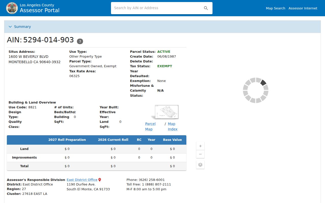
The parcel screenshot is a model for the first log entry in a Montebello street directory search. Save the land identifiers before comparing any person-related source.
Map Layers for the Montebello Street Directory
Map Search is more than a picture of lots. Recovered layers include Assessor Parcels, Street Labels, Cities, Communities, ZIP Codes, School Districts, Supervisorial Districts, Tax Rate Areas, SFR Clusters, Field Books, Map Books, Mobile Home Parks, Oil and Gas Fields and Wells, Public Land Survey, imagery, basemaps, and Pictometry. The Zoning layer labeled “unincorporated” is not Montebello’s zoning authority, so city zoning should be checked with the city rather than inferred from that layer.
To browse a street, center the known address, zoom to readable parcel outlines, choose Get Parcel Detail, and write down the AIN and situs. Return to the map between clicks. Check the parcel opposite the road as well as parcels that touch the subject boundary. A nearby parcel may fall in a different ZIP, school area, council district, community, or tax-rate area, even when the houses appear to share a block.
The Assessor map interface is the verified online route. It supplies parcel discovery, not a public household export.
Montebello Street Directory Records
Each record set in a Montebello street directory has a different key and a different limit. The address works directly for the assessor, parcel map, permits, and some historical directories. It does not work as a direct RR/CC deed query. A voter address appears only through self-verification or regulated products. The coverage table keeps those paths distinct.
| Record set | Keeper | Address clue | Access |
|---|---|---|---|
| Assessor parcel | LA County Assessor | Situs, AIN, legal, map, values, building context | Free address or AIN portal |
| GIS parcel map | Assessor application | Adjacent geometry, layers, street order | Free map browsing |
| Deeds and liens | LA RR/CC Recorder | Recorded party and land transaction | Office terminal or copy request |
| Building permits | Montebello Building & Safety | Applicant, owner, contractor, scope, dates | OpenGov, counter, or CPRA request |
| Voter records | LA County Elections | Registration match or regulated street index | Self-check or authorized request |
| Criss-cross directory | Library or collection holder | Listed occupant and phone by address | Edition and shelf must be confirmed |
The chain is address → AIN → parcel detail → deed reference or permit file. A historical branch may be address → directory entry → census or newspaper. Keeping the branches separate prevents a tax mailing address from being mistaken for a residence or a permit applicant from being treated as a complete household.
Permits as Address Evidence
Montebello Building Permit Application B-001 contains unusually rich address-linked fields. It asks for permit number, site address, scope, area, occupancy group, construction type, fire-sprinkler choice, stories, bathrooms, bedrooms, units, valuation, owner name and contact, contractor, architect or engineer, lender, workers’ compensation information, and Planning, Fire, and Public Works approvals. Public production may redact private phone and email details.
OpenGov handles the city Engineering workflow. An applicant creates an account, selects a permit type, uploads plans and supporting documents, pays online, and tracks status and comments. A public historical-search start date was not located. When a permit is missing from the visible workflow, request a focused file by address and date through City Hall. Ask for permits, inspection history, plans, or correspondence as separate existing record types.
Montebello Engineering shows the current permit route.

The engineering capture connects the modern address record to a city department while leaving private contact fields subject to the custodian’s review.
Montebello Deeds Use Party Names
Los Angeles County real-estate documents are maintained from 1850, but the public property index is not online and cannot be searched by address. The index is keyed by grantor, grantee, and recording year. A grantor transfers an interest; a grantee receives it. A recorder search therefore starts after the assessor has supplied the current parcel, legal description, current vesting, and approximate year.
At Norwalk, 1958–present records are reviewed at headquarters, 12400 Imperial Highway, Room 2207. The 1851–1957 collection is in Room LL001. Headquarters is ordinarily open weekdays from 8 a.m. to 5 p.m.; older-record hours are stated as 8 a.m. to 4:30 p.m. The office advertises limited third-Thursday extended property-search and copy hours. A telephone index search is not offered. Written index searches, in-person inspection, and online, mail, or fax copy orders are the documented channels.
The RR/CC FAQ is the clearest source for the no-address-index rule.
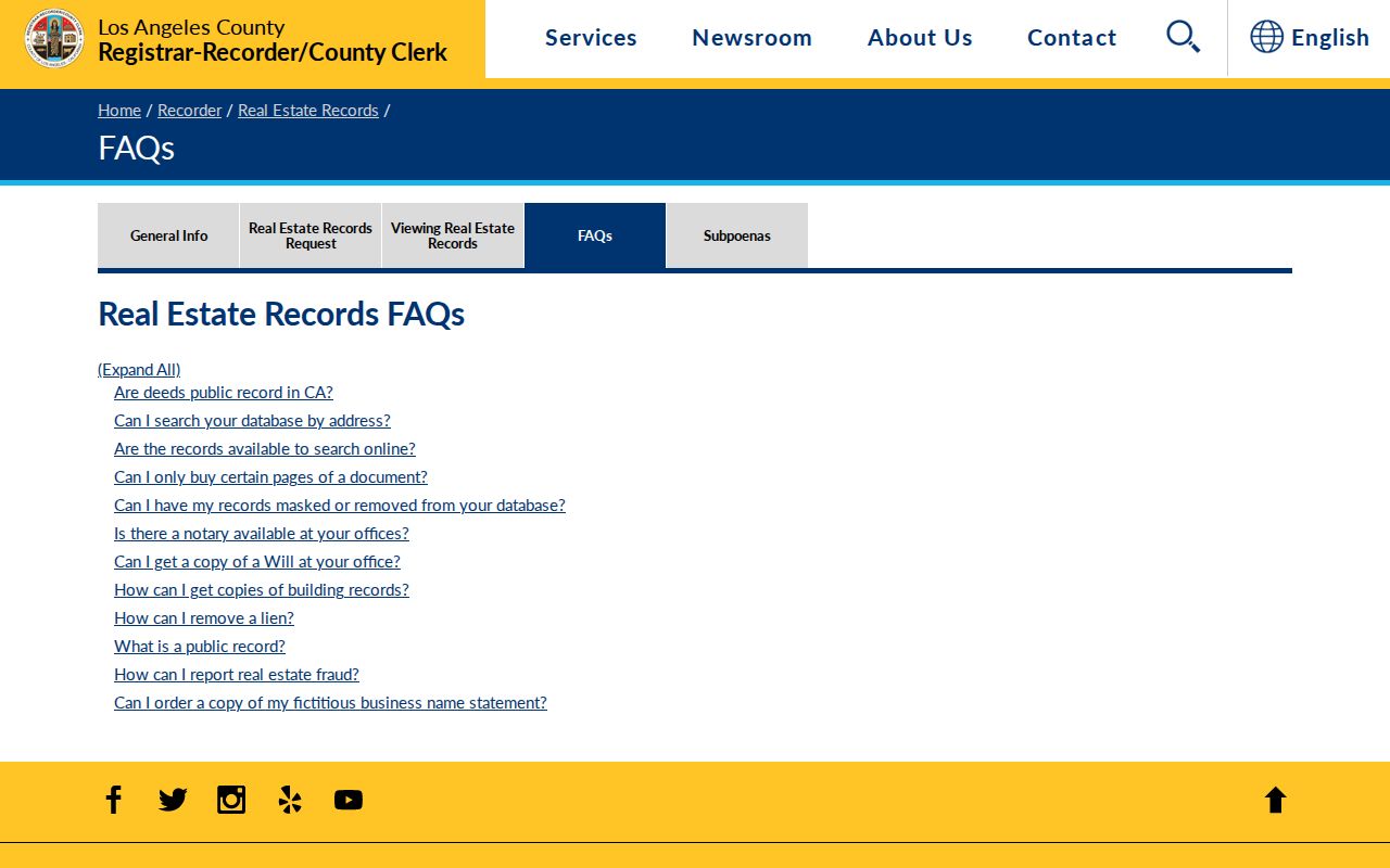
The recorder image is a reminder to carry a party name and year, not only a street name, when leaving the online parcel map.
The 1850 depth is useful for previous residents, but the record may predate Montebello’s 1920 incorporation. Search county, tract, rancho, lot, and legal-description terms when an older street string fails.
Read Montebello Street History
Older address work depends on local identifiers. Montebello’s modern city label should not be pushed backward into every county record. A 1920s parcel may appear under a tract, rancho, lot, or legal description. The 1925 Montebello/Pico Sanborn atlas supplies a building-footprint and street-alignment snapshot for early-incorporation research. Earlier land history belongs with mission, grant, and county archive material.
Printed reverse directories fill a different gap. The verified local shelf includes Alhambra–Montebello Pacific Bell address-and-phone volumes dated June 1987, June 1989, December 1990, December 1991, June 1992, and December 1992. Earlier 1948, 1950, and 1952 Pacific Directory Company titles are cataloged, but their full internal fields were not openly inspected. Treat a criss-cross entry as a listed name and phone at a date, then compare it with census, deed, obituary, or permit evidence.
The Montebello city directories collection explains the shelf and the entry key. It is the right handoff when a street search turns into a historical household question.
Voter Data Is Not a Street Roll
The county voter page requires last name, birthdate, residence house number, and ZIP code. That credentialed form is designed for the person to verify a registration record. It is not a browseable Montebello street directory. County products such as individual voter history, certified registration, county files, city or precinct files, and street-index pages are regulated by purpose, fee, contract, or permitted use.
California Elections Code sections 2188 and 2194 and Government Code section 7924.000 restrict voter fields. Participation history can show whether someone voted in an election, not how they voted. Driver-license numbers, Social Security numbers, signatures, and protected addresses are not ordinary output. If the goal is an address chain, use the assessor and recorder. If the goal is a person’s own registration, use the self-check with the required information.
Parcel, Situs, Plat, Criss-Cross
Four terms prevent many street-search errors. A parcel is a mapped unit of land. A situs address identifies the physical location used for the assessment. A plat is a recorded map or land description that can connect lots and subdivisions. A criss-cross directory reverses the usual name-first order and lists a street or address before the listed occupant.
- AIN
- The Assessor Identification Number used to anchor a Los Angeles County parcel.
- Mailing address
- The destination for correspondence; it need not be the situs or a place where anyone lives.
- Legal description
- The tract, lot, parcel, or other land language that remains useful when street names change.
- Criss-cross directory
- An address-oriented directory section that may list a telephone subscriber or occupant for an edition year.
Use the terms in the right order: USPS normalizes delivery wording, the assessor identifies the parcel, the plat or legal description bridges older land, and the directory supplies a time-bound listed entry.
Montebello Streets and District Lines
Montebello districting materials treat roads, hills and highways, parks, schools, homeowner associations, historic areas, land-use patterns, and transportation corridors as possible communities of interest. Those lines can matter more than a ZIP when comparing two nearby parcels. A street directory entry should therefore record city, ZIP, council district, school area, and tax-rate context separately when each matters.
The city’s district-election page supplies civic geography, but it does not publish a resident list. Use it to understand why adjacent parcels may fall in different districts or communities. For a full street chain, the parcel map remains the starting point; for the block around one address, the neighbor workflow adds the adjacent-click method.
Montebello district maps show the civic boundaries that a ZIP or street name cannot replace.
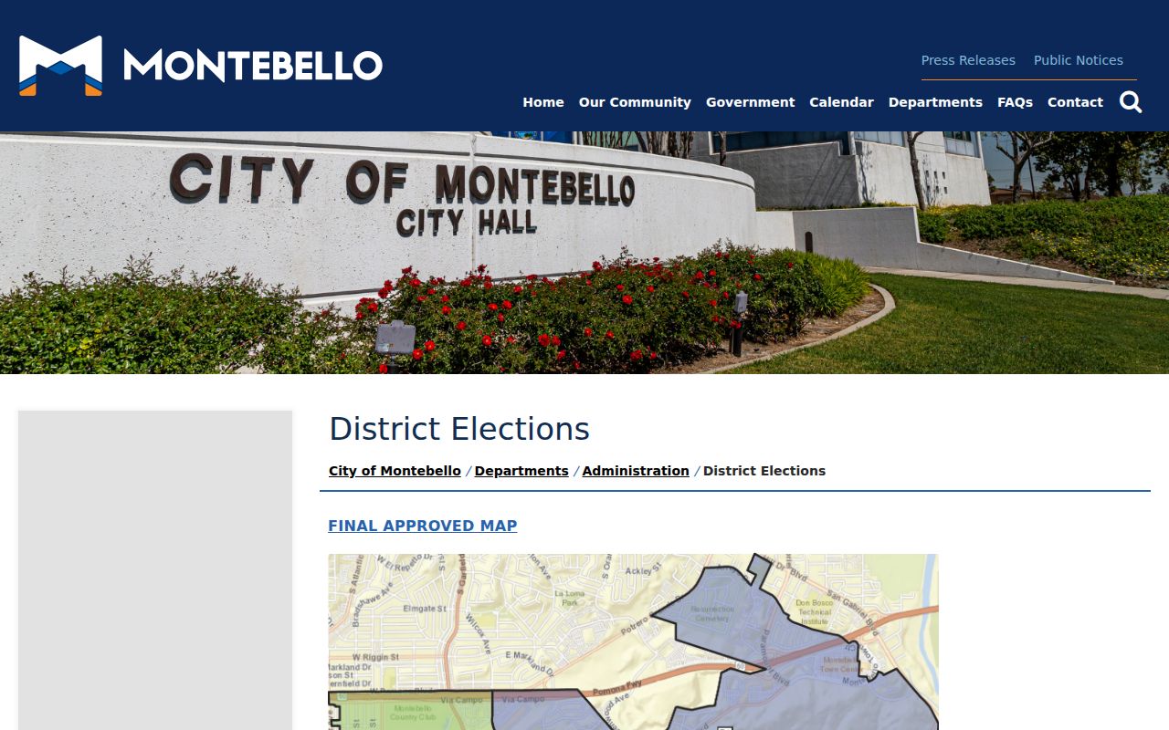
The map capture adds a civic layer to an address log without suggesting that district boundaries identify a household.
Montebello Street Directory Limits
Public address records do not show every person associated with a place. The assessor does not establish occupancy. A deed records a transaction party, not a complete household. A permit names applicants and contractors, not everyone present. The voter form is a self-check. Telephone directories omit unlisted numbers and contain OCR or spelling errors. Utility, delivery, and private household information are not public street fields.
Lawful use. Use Montebello address records for personal genealogy, property history, reconnection, and civic research. Do not use them to stalk, harass, intimidate, or harm anyone.
California Safe at Home participants and other protected people may not appear at an actual residence. A missing name is not evidence of a move, a death, or a false record. Confirm the source rule with the custodian and respect a person’s confidentiality choice.